A Guide to Severe Weather Reporting
The following a is a document developed by Gwinnett ARES member Alan Murray, W4AJM as a guide for
reporting severe weather conditions.
A PDF copy of the document can be downloaded here.
Severe Weather Reporting by the Amateur Radio Emergency Service® for
Gwinnett County, Georgia
By Alan J. Murray, W4AJM, Gwinnett ARES® Central Response Team Member
(Dated May 3, 2011) What is SKYWARN®?
Organized and trained by the National Weather Service (NWS), volunteer SKYWARN® spotters provide essential information for all types of weather hazards, but the main responsibility of a SKYWARN® spotter is to identify
and describe severe local storms. The information provided by SKYWARN® spotters, coupled with Doppler
radar technology, improved satellite and other data, enables NWS to issue more timely and accurate warnings
for tornadoes, severe thunderstorms and flash floods.
Even with all the technology used by the National Weather Service to prepare severe weather warnings,
storm spotters still give the most complete picture of what is really happening in and around severe storms.
Radar simply cannot tell the NWS everything they need to know. Storm spotters are their eyes and ears in
the field. Learn more about the national SKYWARN® program here.
Gwinnett County SKYWARN® Net Activation
Will be called if Gwinnett County is under a severe weather WARNING
May be called if Gwinnett County is under a WATCH and adverse weather is present in a nearby county
May be called if severe weather is spotted which will imminently affect Gwinnett County
When requested by NWS or Gwinnett County ARES® Emergency Operations Center (EOC)
Severe Thunderstorms Equal Severe Weather
The National Weather Service classifies a severe thunderstorm as a storm that has winds greater than or
equal to 58 miles per hour and/or hail one inch (quarter-size) in diameter or larger. Only a few thunderstorms
will be accompanied by downburst winds that are strong enough for the storm to be classified as severe.
Nonetheless, these winds are potentially hazardous to people and property. Thunderstorms that produce very
large hail are also often the type that can produce tornadoes. Hail size is determined by the largest size observed, not an average or mean. Lightning does not factor into the NWS classification of a thunderstorm warning as severe.
All thunderstorms have the potential to produce tornadoes, but the type of storm that is most commonly tornadic is the supercell. This very severe, long-lived thunderstorm contains circulation aloft (mesocyclone) that grows upward through the storm and downward toward the ground. When conditions are favorable, tornadoes will be produced.
Doppler radar can detect the circulation associated with a tornado-producing thunderstorm. Once the circulation is identified, a warning is issued. However, Doppler radar is not perfect, because it can only indicate rotation aloft, and does not indicate what may be happening on the ground. This is where our storm spotters come in. Only feedback
from a trained spotter in the area can confirm whether the radar signature is associated with a tornado.
In the southeast, especially Georgia, tornadoes are often hidden in large swaths of rain and hail that accompany super cell thunderstorms making them very difficult to see and even more dangerous, particularly
at night.
Features such as hills, rolling terrain, or mountains in many parts of Georgia also impede the ability to visually detect a tornado, making accurate, timely reports by a network of spotters on the ground even more important.
Reporting Severe Weather
Spotters provide an invaluable service to their communities and to the National Weather Service (NWS).
Spotter reports help your community by assisting local public safety officials in making critical decisions to
protect lives – when to sound sirens, activate safety plans, etc.
Spotter reports also help the NWS in the warning process. Your report becomes part of the warning decision
making process, and is combined with radar data and other information and used by NWS forecasters to decide
whether or not to:
Issue a new warning
Cancel an existing warning
Continue a warning
Issue a warning for the next county
Change the warning type (from severe thunderstorm to tornado, for example)
What NOT to Report
For your reports to be useful, they should be as detailed, accurate, and timely as possible. Exercise good
judgment when making reports. The intent is not to discourage reports, but to make sure that all reports are useful.
Examples of reports that would not be useful to NWS personnel during severe weather events include:
“dark clouds,” “heavy wind,” “lots of lightning,” “rain,” or “marble-sized hail” (since marbles come in many sizes, give actual size or relate to a coin size such as dime, penny, etc.)
Additionally, the NWS office in Peachtree City does not want spotter reports for the following:
· Rain less than 1 inch per hour
· Lightning, if no damage
· Wind less than 40 miles per hour
· Hail smaller than penny sized (3/4”)
· Situations with authorities already present
· Information heard on official radio channels (Police / fire / EMS / utilities)
Reportable Severe Weather Events
Report any of the following conditions or phenomena as soon as possible.
These are considered urgent or high priority. However, do not disregard your own safety in order to
call in or make a report.
| TORNADO | A violently rotating column of air extending downward from a thunderstorm base that is in contact with the ground, causing swirls of dust, debris, and condensation. Note: Even if in ground contact, the tornado’s funnel bounds may not be visible. |
| FUNNEL CLOUD | A rotating, funnel-shaped cloud extending downward from a thunderstorm base, but is not in contact with the ground, as indicated by the absence of dust or debris. |
| ROTATING WALL CLOUD | A large, cylindrical cloud structure that is lowering from the thunderstorm’s rain-free base and exhibiting persistent, sustained rotation and/or rapid vertical motion. |
| HAIL | Penny size or larger, which is typically associated with severe thunderstorms. Report the largest size hailstone observed. (See charts below for size references.) |
| WIND GUSTS | 40 mph or higher for 5 seconds is reportable. Specify whether speed is estimated or measured. (See chart below for guidelines in estimating wind speed.) |
| FLASH FLOODING | Usually happens within 6 hours of the rain event or because of a dam or levee failure. Most often located at “funneling” points of smaller streams or rivers. |
| RAINFALL RATE > 1″ / hr | Typically associated with severe thunderstorms. May be accompanied by hail. General Guidelines for Estimating Wind Speeds |
General Guidelines for Estimating Wind Speeds
| 30-44 mph (26-39 kt) | Whole trees in motion. Inconvenient walking into the wind. Lightweight loose objects (e.g., lawn furniture) tossed or toppled. |
| 45-57 mph (39-49 kt) | Large trees bend; twigs, small limbs break and a few larger dead or weak branches may break. Old/weak structures (e.g., sheds, barns) may sustain minor damage (roof, doors). Buildings partially under construction may be damaged. A few loose shingles removed from houses. |
| 58-74 mph (50-64 kt) | Large limbs break; shallow rooted trees pushed over. Semi-trucks overturned. More significant damage to old or weak structures. Shingles, awnings removed from houses; damage to chimneys and antennas. |
| 75-89 mph (65-77 kt) | Widespread damage to trees with large limbs down or trees broken/uprooted. Mobile homes may be pushed off foundation or overturned. Roof may be partially peeled off industrial/commercial/ warehouse buildings. Some minor roof damage to homes. Weak structures (e.g., farm buildings, airplane hangars) may be severely damaged. |
| 90+ mph (78+ kt) | Many large trees broken and uprooted. Mobile homes damaged. Roofs partially peeled off homes and buildings. Moving automobiles pushed off the road. Barns, sheds demolished. |
Some Commonly Used References For Hail Sizes
| Pea | .25 inch |
| Golf Ball | 1.75 inch |
| Mothball / M&Ms | .50 inch |
| Hen Egg | 2.00 inch |
| Penny / Dime | .75 inch |
| Tennis Ball | 2.50 inch |
| Nickel | .88 inch |
| Baseball | 2.75 inch |
| Quarter | 1.00 inch |
| Tea Cup | 3.00 inch |
| Half Dollar | 1.25 inch |
| Grapefruit | 4.00 inch |
| Ping Pong Ball | 1.50 inch |
| Softball | 4.50 inch |
For additional help in determining hail size, please refer to the chart here.
How To Report Severe Weather Events
Reporting method (in order of preference):
· Via Gwinnett County ARES® / SKYWARN® net (using a W4GR repeater frequency)
If not available, then
· Via an adjacent county ARES® net
If not available, then
· Via the regional NWS Peachtree City net (to the WX4PTC base station)
If not available, then
· Direct to NWS in Peachtree City by phone at 770-486-9269 or 1-866-763-4466
Or submit an online storm report to the NWS Weather Forecast Office in Peachtree City
Your severe weather report should be detailed but concise, and should address the following:
WHO you are: Give your call sign and current fixed/mobile location.
WHAT you have seen: Tornado, funnel cloud, rotating wall cloud, quarter size hail, flash flooding, etc.
WHERE you saw it: To avoid confusion, report the severe weather event location and not your location.
Give the direction and distance from a known, easily fixed position. Reports that include a cross street or distance
and direction from a cross street where spaced further apart are best,
e.g., “1/2 mile east of the South Old Peachtree Road and Lou Ivy Road intersection.”
WHEN you saw it: Make sure you note the time of your observation (not the time you report it).
WHAT it was doing: Describe the storm or event’s direction and speed of travel, size and intensity, and destructiveness. Include any amount of uncertainty as needed, i.e., “funnel cloud; no debris visible at the surface,
but too far away to be certain it is not on the ground.”
Your personal safety comes first, before anything else. Don’t become a storm statistic!
Gwinnett County ARES® / SKYWARN® Net Severe Weather Reporting Procedure
The following procedure is recommended when making a severe weather report during any weather event on any frequency for the Gwinnett County ARES® / SKYWARN® net.
Collecting accurate, timely information from spotters is vital. Lives could be at stake, so exercise discipline at all times and employ good operating practices during the net. Remember, this will be a formal, directed net. As a good net participant, much of your time will be spent monitoring the frequency rather than transmitting. Only call the NCS when directed to or if you have relevant traffic.
Important points to remember when making a report:
⋅ Be sure of your observation (use measured reports for wind speed, rain, etc., when available).
⋅ Take a moment to formulate your report before keying the microphone. Be sure that you have all the
required information. (See the text box below for a suggested format).
⋅ Be sure to include the type of event you are reporting during your initial contact.
This helps the NCS prioritize reports that may come in at the same time.
⋅ If mobile, know your location at all times. This is as much for your own safety as it is for reporting accuracy.
Once phenomena has been identified and determined to match severe weather criteria, the spotter should call net control indicating a severe weather report, e.g., “This is W4AJM with a hail report.”
Wait for acknowledgment from the NCS, continue with your location, and provide a concise description of the severe weather observed, including its movement and location. Use the “5 W’s” method of reporting as described above:
“Who, What, Where, When, What.”
Example: “This is W4AJM located in Lawrenceville on Grayson Highway, 1/2 mile south of Davis Road, reporting quarter size hail observed at 1309 local time. I am watching a funnel cloud form at the base of a thunderstorm approximately 3 miles west of my location. The funnel cloud appears to be moving east-northeast. No debris is visible at the surface.”
Example: “This is W4AJM located in Duluth at Buford Highway and Pittard Road reporting a tornado observed
on the ground 2 miles south of my location at 1342 local time. The tornado is moving east.”
This is [call sign] located in [town or city] at / on [cross street or distance and direction from cross street] reporting [type of severe weather phenomenon or event, i.e., tornado, hail (specify size), funnel cloud, rotating wall cloud, wind > 40 mph, flash flooding, rain >1 in/hr] observed [give location of severe weather phenomenon or event relative to your location, i.e., “2 miles south of”] my location at [24 hour clock] local time. The [specify event] is moving [provide direction based on 16 compass points, i.e.,
“north-northeast”]. Provide additional information that will be helpful to public safety officials or
the National Weather Service, such as “debris visible at the surface,” “power lines down,” or
“significant damage to buildings.”
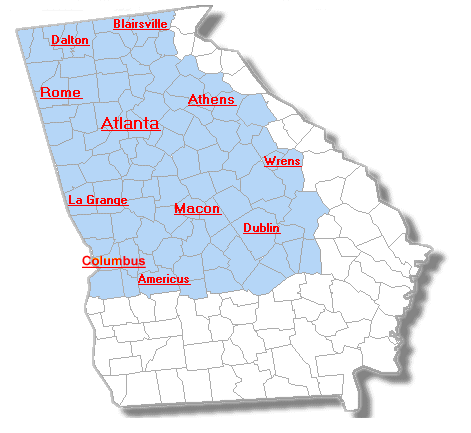
National Weather Service Weather Forecast Office Severe Weather County
Warning Area
The NWS Weather Forecast Office in Peachtree City issues severe weather warnings (i.e. Tornado Warnings,
Flash Flood Warnings, etc.) for 96 counties in northern and central Georgia as depicted in light blue on
the map below. This region is known as that office’s “CWA” or County Warning Area.
Peachtree City NWS Office “CWA” (County Warning Area)
Helpful Severe Weather Links
NWS Peachtree City, GA Severe Weather Summary Page
National Weather Service Storm Spotter’s Glossary
Tornadoes: Nature’s Most Violent Storms